After another bit of a delay on account of there just being too much to do in New Zealand, here comes a bit of a rundown of the last couple of weeks, starting with the end of my time on the South Island.
From Franz Josef, I hitched what just might be the best and luckiest ride of my trip: the second I put down my bags on the roadside and stuck my thumb out to passing traffic, a car pulled over - literally the first one that spotted me. I didn't think things like that happened, but there you go! It turned out to be a family who, by complete chance, I had taken a photo of the day before at Franz Josef Glacier, although we only realised this once I was in the car. The Kinlochs - Dean, Annie, Riley (10) and Claudia (8) turned out to be delightful company and the perfect ride: we ended up stopping at loads of little attractions and roadside scenic spots, making the long and beautiful drive to Queenstown all the more pleasant.
Our first stop was at Fox Glacier. Practically down the road from Franz Josef, it looks far smaller on maps and photos but is actually a lot more impressive mostly because it is possible to walk far closer to it. The subglacial channels where water drains from beneath the glacier are also clearly visible and give rise to the river flowing downvalley. The second photo is of me with the Kinlochs.


After this, the road to Queenstown became increasingly more scenic (I'm running out of superlatives here...), veering inland from the coast and across one of the major passes crossing the Southern Alps before descending again into the lake country at the southern tip of New Zealand.


Queenstown itself was even more fully booked up than can be expected for the high season on account of a concert held nearby which seemed to attract an enormous crowd of middle-aged people looking for a good time. With my tent, I was not overly worried about finding a spot to sleep - campsites never fill up completely - but I was in for a rather more pleasant surprise.
Having been driven all the way to Queenstown - a 7-hour trip at our leisurely pace - the Kinlochs found they had a spare guest bed in their stunning motel room and promptly offered for me to crash there, and to then drive me part of the way to Te Anau the next day. Such a spontaneous display of kindness caught me completely off guard, but has reinforced my belief in Kiwis as generally amazing people.
And so it was, after tasty steaks and cider for dinner - what a change from the standard backpacker fare of pasta and cereals! - that we continued on towards Te Anau together the next day. Te Anau is the end of the road as far as settlements in the Fiordland region are concerned, and it lies on the road towards Milford Sound, my ultimate destination down here.
A short drive later, then, I said goodbye to this lovely family at the intersection where they'd be heading off in the direction of Invercargill, and was promptly picked up by a friendly 18-year-old German called Simon who slept on a mattress in the back of his sedan. Te Anau, being at just over 45 degrees southern latitude, was not only my "furthest South" but also my "furthest from home": 18920 km/11755 miles from Cambridge, and accordingly slightly less from Vienna and London. I had planned to do a bit of hiking in this mountainous area not dissimilar from some parts of the Alps, but as there were reports of the weather turning I decided to head to Milford Sound sooner rather than later: the 6-hour guided kayaking trip I was planning to do here was my biggest one-off expenditure on anything other than flights so far, and as such I figured it would be best to maximise my chances of fair weather.
The Milford Road is famous for its desolation and its rise to steadily greater heights into fiord country, but mostly it was littered with tour buses standing by the roadside disgorging camera-wielding tourists. I couldn't help but feel a little smug as Simon and I cruised past all these at our leisurely pace - although we couldn't help but stop and stare ourselves a few times...

Milford Sound itself is an odd one. Enormous parking lots and the ugliest, most jarringly out-of-place grey-faux-marble boat/cruise ship terminal in history apart, it is a place of exceptional beauty. Since the internet is bursting with stock photos significantly better than mine, see here and here for what sort of place we're talking about. It really does have the lot - beautifully clear cobalt blue water (although it is normally murky due to sediment-heavy runoff, recent droughts meant it was nice and clear), steeply rising peaks some 2000m high, ice fields at their tops and waterfalls crashing down from phenomenal heights. And, let us not forget, a constant drone of propeller plane engines and cruise ships making an absolutely outrageous profit. A few of my own impressions of the place at daytime are below.


The next morning, clouds lay heavy on the fiord. As expected, this meant that the peaks surrounding the water were out of sight, it did mean that the light on the water itself was a lot more pleasant while the sun burned steadily away at the layers of cloud above us. We saw the lot - during the 6-hour trip which saw us kayak from the harbour all the way out into the Tasman Sea (23km), we came across a pod of dolphins, a big and playful group of fur seals throwing themselves into various yoga-like poses - and a couple of rarely seen yellow-crested penguins which I completely failed to photograph but which were exactly as one might expect penguins to be: hilariously clumsy and dopey-looking.


We also got to paddle past and under a few stunning waterfalls - the water crashing down from over 100m creates a fair bit of wind which pushes the kayak right back out of the danger zone once you stop paddling.


On the way back in we were picked up by a speedboat - just as well, as my core was not impressed at this amount of kayaking and my knee seemed to have taken a hit from being pushed against the kayak's plastic hull for hours. As it turned out, the morning clouds were actually a blessing: by the time we hopped onto the boat, the sun was as bright as ever so we got the best of both worlds.
Hitchhiking back out from Milford Sound had the potential to be a tricky affair due to a complete lack of good places for cars to pull over - but fortune was kind to me yet again. I was slightly confused to see a car stop for me which I had just seen go down to the Sound 5 minutes before - it turned out the driver, Beth from Michigan/Colorado, had gone to all the trouble of turning around to give me a lift out! My knee hurting from the kayaking to an extent that made me doubt I'd get much hiking done in Te Anau, I decided on a whim to go all the way back to Queenstown with her and chill there for a few days before catching my flight to Wellington.
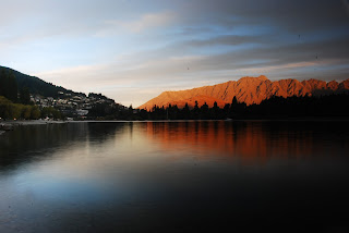
This turned out to be a good choice as my knee took several days to improve so that I spent my days in Queenstown doing very little, and thoroughly enjoying it. It is, it has to be said, an almost ludicrously picturesque town, although its posh, Aspen-style shops did not really cater to my taste or budget. Still, walking around its fringes and finding pleasant spots to sit and read provided me with plenty of entertainment, as did a trip out the historic mining community of Arrowtown with Beth.

Right - this concludes my adventures on the South Island. Hope this wasn't too long or gruelling a read - as always, feedback is much appreciated!
From Franz Josef, I hitched what just might be the best and luckiest ride of my trip: the second I put down my bags on the roadside and stuck my thumb out to passing traffic, a car pulled over - literally the first one that spotted me. I didn't think things like that happened, but there you go! It turned out to be a family who, by complete chance, I had taken a photo of the day before at Franz Josef Glacier, although we only realised this once I was in the car. The Kinlochs - Dean, Annie, Riley (10) and Claudia (8) turned out to be delightful company and the perfect ride: we ended up stopping at loads of little attractions and roadside scenic spots, making the long and beautiful drive to Queenstown all the more pleasant.
Our first stop was at Fox Glacier. Practically down the road from Franz Josef, it looks far smaller on maps and photos but is actually a lot more impressive mostly because it is possible to walk far closer to it. The subglacial channels where water drains from beneath the glacier are also clearly visible and give rise to the river flowing downvalley. The second photo is of me with the Kinlochs.


After this, the road to Queenstown became increasingly more scenic (I'm running out of superlatives here...), veering inland from the coast and across one of the major passes crossing the Southern Alps before descending again into the lake country at the southern tip of New Zealand.
 |
| A valley completely shrounded in clouds. Dean steered the car right to the edge of the precipice, giving the kids a good scare! |


Queenstown itself was even more fully booked up than can be expected for the high season on account of a concert held nearby which seemed to attract an enormous crowd of middle-aged people looking for a good time. With my tent, I was not overly worried about finding a spot to sleep - campsites never fill up completely - but I was in for a rather more pleasant surprise.
Having been driven all the way to Queenstown - a 7-hour trip at our leisurely pace - the Kinlochs found they had a spare guest bed in their stunning motel room and promptly offered for me to crash there, and to then drive me part of the way to Te Anau the next day. Such a spontaneous display of kindness caught me completely off guard, but has reinforced my belief in Kiwis as generally amazing people.
And so it was, after tasty steaks and cider for dinner - what a change from the standard backpacker fare of pasta and cereals! - that we continued on towards Te Anau together the next day. Te Anau is the end of the road as far as settlements in the Fiordland region are concerned, and it lies on the road towards Milford Sound, my ultimate destination down here.
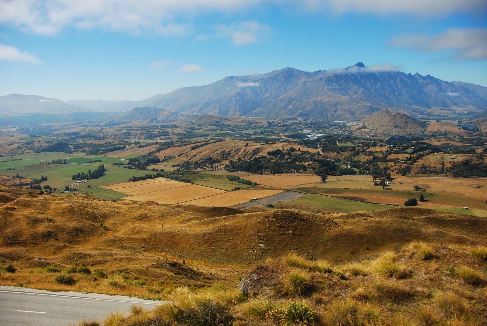 |
| Just out of Queenstown, looking across at the Remarkables once more. |
 |
| Early morning in Te Anau - it was getting rather chilly at this point, so the time came to break out the powertraveller stash... |

 |
| The Homer Tunnel leading down to Milford Sound. Being used to the spotless, clinical tunnels one finds in the Alps, I was more than a bit surprised to find this rough-hewn, practically unlit, one-lane-with-passing-bays, steeply descending affair at one of New Zealand's main tourist throughfares! |


Naturally, I couldn't miss the chance to try for some good shots at sunset, too - although to my dismay heavy clouds began rolling into the fiord in the evening, dampening my hopes for a clear morning the next day. This peak, illuminated by the last vestiges of the setting sun and reflected in a stagnant bit of water coloured red for some reason, is my only result even vaguely worth showing.

 |
| Interesting light as the sun sets behind jagged mountains - it briefly illuminated the sky much like one of those giant Las Vegas searchlight things would. |


We also got to paddle past and under a few stunning waterfalls - the water crashing down from over 100m creates a fair bit of wind which pushes the kayak right back out of the danger zone once you stop paddling.


On the way back in we were picked up by a speedboat - just as well, as my core was not impressed at this amount of kayaking and my knee seemed to have taken a hit from being pushed against the kayak's plastic hull for hours. As it turned out, the morning clouds were actually a blessing: by the time we hopped onto the boat, the sun was as bright as ever so we got the best of both worlds.
Hitchhiking back out from Milford Sound had the potential to be a tricky affair due to a complete lack of good places for cars to pull over - but fortune was kind to me yet again. I was slightly confused to see a car stop for me which I had just seen go down to the Sound 5 minutes before - it turned out the driver, Beth from Michigan/Colorado, had gone to all the trouble of turning around to give me a lift out! My knee hurting from the kayaking to an extent that made me doubt I'd get much hiking done in Te Anau, I decided on a whim to go all the way back to Queenstown with her and chill there for a few days before catching my flight to Wellington.
This turned out to be a good choice as my knee took several days to improve so that I spent my days in Queenstown doing very little, and thoroughly enjoying it. It is, it has to be said, an almost ludicrously picturesque town, although its posh, Aspen-style shops did not really cater to my taste or budget. Still, walking around its fringes and finding pleasant spots to sit and read provided me with plenty of entertainment, as did a trip out the historic mining community of Arrowtown with Beth.


Right - this concludes my adventures on the South Island. Hope this wasn't too long or gruelling a read - as always, feedback is much appreciated!


